Surroundings
Avola

"Welcome to the land of the Nero d'Avola, lemons and the mandorla. The land that transforms the sun's rays into aromas and flavours."
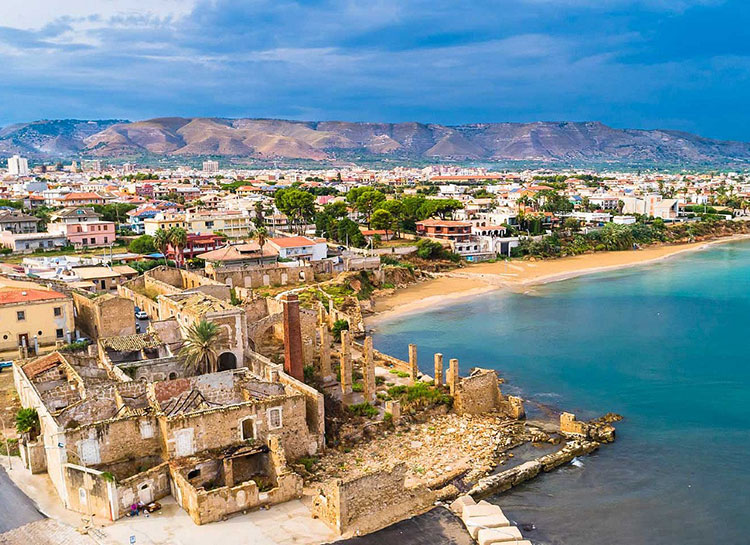
Avola stretches along the coast, in the area south of Syracuse, along one of the oldest Greek routes in Sicily: the Via Elorina. The area in which it is located is an exceptional container of cultural and environmental assets, of which the city is the "gateway".
From the large Piazza Umberto I°, formerly Piazza Maggiore in the famous hexagonal historic centre, the Baroque "streets" begin and lead to the spectacular nature reserves of Cava Grande del Cassibile and Vendicari..
The flat site of the town of Avola is located in an extraordinary landscape, between the Ionian Sea and the Iblei mountains, between a coastline with warm, fine, golden sandy beaches and the coolness and scents of the Iblei hills surrounding it to the north-west.
This favourable microclimate allowed the cultivation of sugar cane - from the 15th to the 19th century -, vines, almonds and lemons, the fruits of which continue, even today, to provide excellent products.
Avola has linked its name to world-famous agricultural products such as the mandorla or 'Pizzuta di Avola', the wine called 'Nero d'Avola' and the lemon 'Femminello Siracusano'.
The Avola Almond, with its perfect oval shape, as Leonardo Sciascia wrote, and the Nero d'Avola, originating from the ancient vine of the same name, are famous throughout the world for their unmistakable flavours.
The main feature of the Avolese coastline is the 'Rotonda sul mare', a major tourist attraction where evenings of music and entertainment are held.
Noto

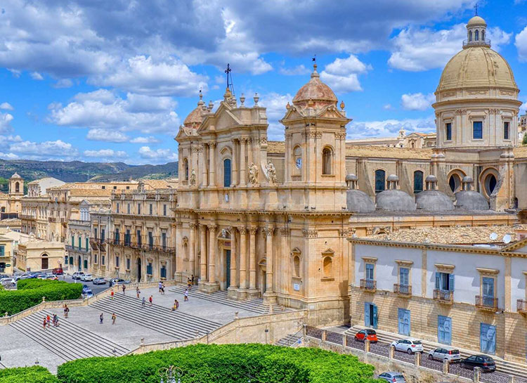
In a region where olive and almond trees abound, Noto is a small Baroque jewel perched on a plateau overlooking the citrus-covered Asinaro Valley.
Its beauty, so harmonious that it seems like a fiction, the scene of a theatre, was born of a tragic event: the earthquake of 1693, which brought destruction and death to this part of Sicily, but gave impetus to reconstruction. Before that, the town stood 10 km away.
Of very ancient origins, Noto was the birthplace of Ducezio, who in the 5th century BC caused the Greeks to tremble because he had the Siculs rise up against them.
The 1693 earthquake completely destroyed the city. A less impervious and larger site was chosen for the reconstruction, allowing for the creation of a simple, linear layout, with right-angled intersections and parallel, widened streets in keeping with the new Baroque taste.
Three main roads run from east to west so that the sun always shines on them.
Three social classes settle there: the first, highest, is for the nobility, the middle for the clergy (the only exception is the centuries-old Landolina palace), The palaces are majestic, all built in the local limestone, soft and compact, with a whiteness that time has coloured, creating that magnificent golden and pinkish hue that the light of sunset accentuates, this reconstruction, conducted by the Duke of Camastra, the Spanish viceroy's representative in Noto, involved many Sicilian artists, including Paolo Labisi, Vincenzo Sinatra and Rosario Gagliardi, who, influenced by Borromini, is perhaps one of the most inventive.
The city is built as if it were a stage set, studying and making up the perspective in a singular way, playing with the lines and curves of the façades, with the decorations of the corbels, the curls and volutes, the masks, the putti, the balconies with wrought iron parapets that bend into graceful, potbellied forms.
Original creations by local masters. However, Noto is part of the panorama that from the hands of Italian artists saw the Baroque dream flourish throughout Europe and that gave life to the new Russian capital, St Petersburg.
Syracuse

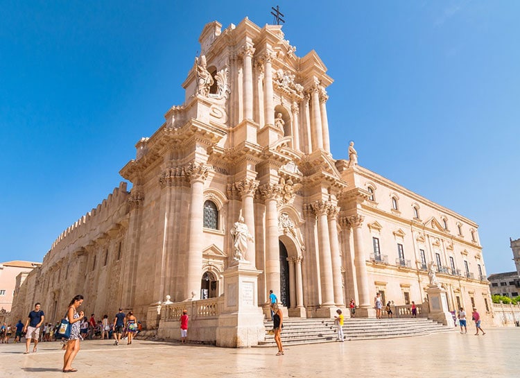
The city of Syracuse is developed partly on the promontory-island of Ortigia and partly on the mainland. The conformation of the coast determines the wide inlet of Porto Grande, surrounded to the north by the island and to the south by the promontory of Plemmirio.
Its geological aspect is included in the Hyblean Area; this area is a structure that constitutes part of the northern offshoots that emerged from the African Plate, which has in the Mediterranean, and therefore in Sicily, its point of collision with the European Plate.
But this area has another peculiarity, in fact geophysical researchers have discovered that in the area of the Monti Iblei a separate plate has formed, called "micro-plate siculo-iblea", it is part of the African plate but has its own dynamics, includes much of Sicily and the surrounding seas and is responsible for the strongest earthquakes occurred in the eastern part of the island.
The Iblei Mountains are composed of white calcareous shell rocks, more precisely of carbonate rock originating from marine sediments deposited in the Miocene; in fact, the area where Syracuse now stands was once submerged by water, as evidenced by the many shell fossils visible on the surrounding rocks.
Its mountains are not very large, as the town is close to the coast; they are mostly hills, the highest peak being Mount Epipoli. In the vicinity of Cassibile, however, there is a large canyon, which has been carved out over the centuries by the Anapo River.
The Anapo is one of the rivers of Syracuse, flowing for forty kilometres, and has a mainly torrential character; then there is the river Ciane, a short watercourse that flows into the Porto Grande, where it joins the Anapo; it is a perennial river that is also fed during the summer period.
Another river is that of Cassibile, thirty kilometres long, winding its way between the municipalities of Palazzolo Acreide and Avola, then flowing into the Ionian Sea.
The artificial canals that run through Syracuse are: Mammaiàbica, Pismotta and Regina. The lakes and small waterfalls are located within Cava Grande del Cassibile.
In the city there is a freshwater spring, the renowned Aretusa Spring, and an artificial cave, called the Grotta del Ninfeo, from which water from the Galermi aqueduct flows.
Syracuse faces the Mediterranean Sea, with the Ionian Sea basin. Its coastline is mainly formed by rocks, but there are also wide sandy beaches.
It is bordered to the north by Priolo Gargallo and Città Giardino (district of Melilli), to the west by Solarino, Floridia, Palazzolo Acreide, Noto and Canicattini Bagni and to the south by Noto and Avola.
The territorial boundaries are delimited to the north by contrada Targia; to the west by Belvedere, a panoramic outpost; and to the south by Cassibile and Fontane Bianche.
Marzamemi

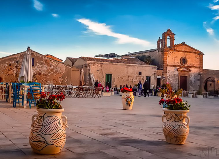
Marzamemi is a seaside village of which a part is the municipality of Pachino from which it is about 3 km away and a second part is the municipality of Noto from which it is 20 km away. It is located in the province of Siracusa.
The name derives from the Arabic Marsà al-hamām, which means "Bay of the Turtledoves", as the area is an obligatory place of passage for small birds during migration.
The village grew up around the landing place, which later became a fishing port, and developed thanks to the latter activity, which is still widely practised today, and was also equipped with a Tonnara, one of the most important in Sicily.
The tonnara of Marzamemi dates back to the time of the Arab domination in Sicily. In 1630 it was sold by the owner to the Prince of Villadorata.
The Villadoratas reinforced the buildings of the tuna fishery by bringing skilled carpenters from Avola and Syracuse, who then remained resident in Marzamemi.
In 1752 they built the palace and the church of the tonnara, and the sailors' cottages. In 1912 a factory was built in Marzamemi to process salted tuna and later tuna in oil.
Tuna fishing was abundant until after the war. In the past, ships also left from the port of Marzamemi to transport large quantities of locally produced wine to various ports in the peninsula.
The wine was also transported by goods trains to various places abroad, Marzamemi having been provided with a railway station. Until 31 December 1985, it could also be reached by passenger trains on the railway that runs from Syracuse and Noto along the territory of the Vendicari Reserve to Pachino.
Another source of development is the fishing and processing of seafood products: famous is, for example, the bottarga of bluefin tuna, processed using ancient artisanal drying systems derived from the Arab-Phoenician culture.
Marzamemi has a beautiful beach: in recent years, it has focused on tourism, offering the possibility of numerous equipped moorings for pleasure boats.
In summer, the population increases considerably, thanks also to the residential settlements that have sprung up near the old village.
In August, St Francis is celebrated with a procession of boats, a cuccagna at sea and a regatta.
In 1993, the historic village was used as a location by director Gabriele Salvatores for the film Sud, starring Silvio Orlando, Claudio Bisio and Francesca Neri.
Since 2000, Marzamemi has hosted the Festival of Frontier Cinema.
